Front Cover
TAC
Table of Contents
Contact Information
|
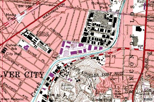
From David Bedinger: I enjly your site so very much. Here is another interesting tidbit on the Desilu site as shown above. This topographical map was generated by the USGS. The purple buildings, grouped in the triangle, are the Forty Acres backlot from 1981.
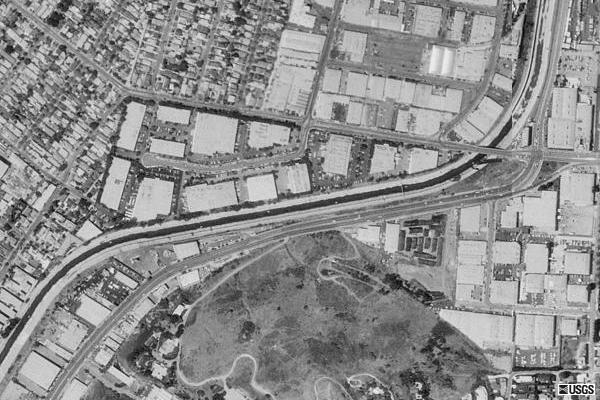
From David Bedinger: I think your readers may also be interested in the photo below. This is a 1991 USGS aerial shot of the old RKO/Desilu Forty Acres backlot. The doglegged road at the top is Higuvera and the concreted basin follows Jefferson. As in the top photo, the triangle formed is the old backlot, now an industrial park. If you haven't already read it, please read Metropolis and Mayberry. |
"Like
The Only Real Magic -- The Magic Of Knowledge"